What the Maps and the Ministry Say About Juanillo Beach
Juanillo Beach is a long stretch of sand on Cap Cana's east-facing shore, about 1.9 miles of it by the estimate in the Ministry of Environment's 2024 management plan for the marine sanctuary that covers this coast, and from Puerto Marina it is a 4-minute drive. Most descriptions of Juanillo stop at the white sand and the palms; this one reads the beach from that plan and from the map instead: why sand gathers here at all, the protected sea in front of it, the fishermen who carry its name, and the short, measured route from Puerto Marina, gate included.
How long is Juanillo Beach, and how close is Puerto Marina?
About 1.9 miles of sand, which is longer than a pin on a phone map suggests. That is the estimate in the Ministry of Environment's management plan for the Southeast Reefs Marine Sanctuary, published in 2024 and drawn from aerial imagery and field work. OpenStreetMap outlines a much shorter stretch, further north-east along the shore, under that name. The coordinates the plan lists for the beach fall on the shoreline about 0.3 miles from Puerto Marina's published location.
Puerto Marina describes its address as lying between Blue Lake and Juanillo Beach, and the building stands 660 ft from the sea. Being near the shore is not the same as having a way down to it, though. Under Ley 305 of 1968, roughly the first 200 feet inland from the high-tide line is public, but the land behind the sand can be private, so the dependable route to the beach is the road. Measured on a public routing engine from the development's published location to the nearest edge of the stretch OpenStreetMap labels Playa Juanillo, it is about 0.95 miles, by Vía del Puerto and Boulevard Marino, in line with the 4-minute drive the development publishes.
Why does sand collect at Juanillo at all?
Because something shelters it. The sanctuary plan describes this coast as running from north-east to south-west and facing the wind and swell that arrive from the east, the direction that blows and breaks most often and with the most energy. Where that energy reaches the shore unbroken, the coast is rock: low terraces or cliffs. Sand collects only where the force is taken out of the sea, by a bend in the shore, a cove, or a coral reef acting as a breakwater, and the plan places a barrier reef along part of the Cap Cana and Punta Cana coast. On the roughly 13 miles of shore between Cabo San Rafael and the marina at Punta Cana, it counts only about 2.3 miles of sandy beach, and Juanillo is most of it.
The sand itself comes largely from the reef. The plan explains that sand on this sheltered coast is mostly biogenic, made from the remains of reef life rather than washed down by rivers, and the part of the sanctuary that takes in Cap Cana receives no significant river input. Visitors' descriptions of the water fit that picture: calm and shallow a long way out, better for wading and floating than for swimming lengths. The same plan also records a caution. The development of this coast, together with a changing climate, has altered some sectors of its beaches and may have made erosion worse, so judge the shore on a visit rather than from old photographs.
What does the marine sanctuary mean for a day at Juanillo?
The sea in front of Juanillo is protected water. The Southeast Reefs Marine Sanctuary was created in 2009 by Decree 571-09 and covers about 3,000 square miles of sea, along a coastline that takes in Cap Cana. Its 2024 management plan zones the coral reefs, from the shore outward, as a conservation zone where tourist diving should come with reef-care education and diving and fishing are not to share a site. Within that zone it sets aside a few strict conservation areas, marked and open only to research, and the elkhorn coral areas of Cap Cana are among them: no tourist diving and no fishing.
On the sand none of this changes much; in the water it changes what you may take. Rules adopted in 2017 for these waters, as the plan summarises them, restrict fish traps and spearfishing, ban compressor diving and trammel nets, protect parrotfish, sharks and turtles, and set closed seasons for lobster and conch. The habits follow from them: look rather than collect, keep your feet off living coral, and book snorkelling or diving only with a guide who briefs you on the reef first. The zoning is the plan's, so ask where a trip will go before you assume a stretch of reef is open to visitors.
Is Juanillo only a beach?
No. Juanillo is also the name of a paraje, a rural locality, in the Verón-Punta Cana municipal district: the sanctuary plan lists it among the district's coastal localities, alongside Cabo Engaño, La Salina, Punta Cana, Borrachón and Pantanal. A hotel group's guide to the beach, published in February 2026, says Juanillo was once a small village whose families lived from fishing and farming, before this coast became a holiday destination.
The fishing has not gone. The plan records that Punta Cana's fishermen are organised in an association that carries Juanillo's name, with about forty active members, although navy figures it cites show only about ten boats going out on a given day, crewed by fifteen to twenty fishermen. Their work has shrunk under the 2017 rules: they now fish mainly by line and spear in the shallow reef areas still open to them, for octopus, lobster and reef fish, and they sell through intermediaries and fish shops in Verón and Higüey that supply hotels and restaurants. Many have moved to fish off Cabeza de Toro, and a number were hired to support research, clean beaches and build and maintain the barriers that hold back sargassum. The beach's name, in other words, still belongs to people who work this coast's water.
How do you get from Puerto Marina to the sand, and how do guests get in?
Juanillo lies inside Cap Cana's gates, and so does Puerto Marina, so for an owner the trip to the beach is the short drive described above, and the checkpoint that matters most is Cap Cana's main entrance. Cap Cana's owners' access page explains how that works. An owner carries an identification card issued by customer service at the Information Center by the main entrance, and can request cards for immediate family, meaning a spouse and children under 28.
Guests are where a little planning pays off, because a beach day for friends begins at that entrance. Travel writers report that day visitors arriving on their own register with security and show a photo ID; a guest of an owner can be registered ahead instead. The page's process is short, and the steps below follow it. It does not say whether someone who books a short stay through a rental platform counts as a visitor or as a tenant, so confirm that with Cap Cana's customer service and the building's management before promising anyone a day at Juanillo.
-
Register visitors in advance Email the front desk or use the Cap Cana app, which issues a digital access ticket.
-
Give the details asked for The visitor's full name, a copy of an identity document, where they are going and how long the pass should last.
-
Handle tenants separately Before signing a lease, send customer service the identity documents of the tenant and everyone who will live with them; cards go only to those who pass its review.
-
Settle the short-stay question Ask customer service and the building's management which route applies to a guest booked through a rental platform, because the page does not say.
What does Juanillo add to owning at Puerto Marina?
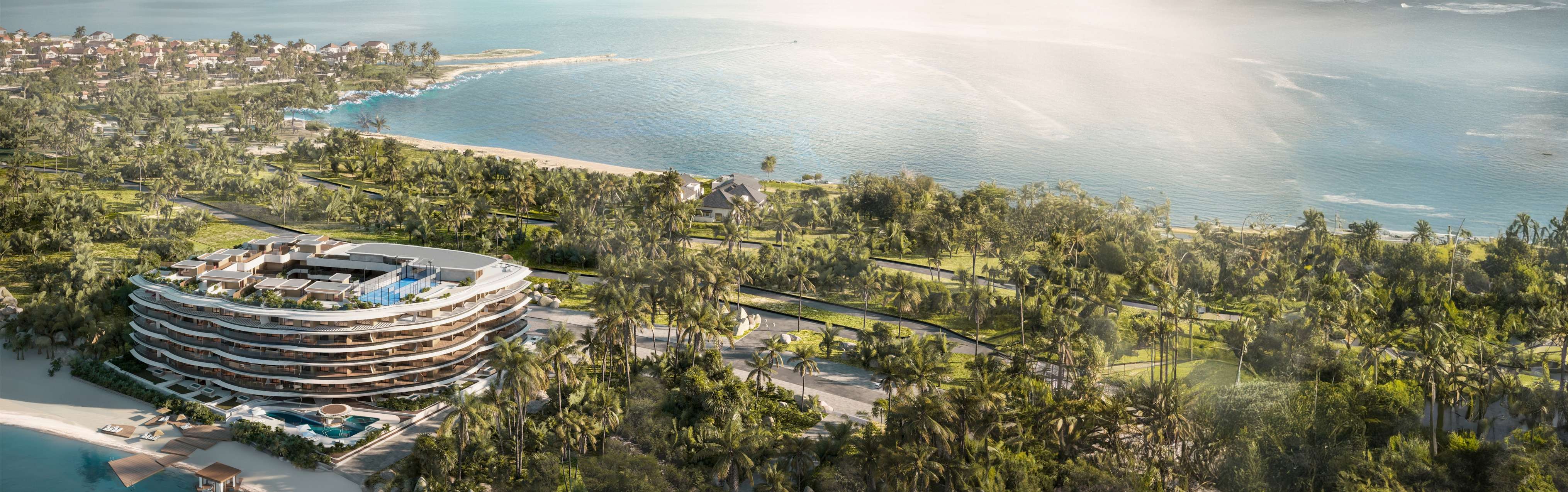
A long, protected beach a short drive from the water you already have at home. Puerto Marina is our development of 97 residences in Cap Cana, 660 ft from the sea, with a private beach on Blue Lake, a beachfront infinity pool and a rooftop panoramic infinity pool, residences from the mid $500,000s and delivery planned for 2029. The lake beach and the pools take care of the everyday swim; Juanillo, 4 minutes by car, is the sea beach for an early walk on the sand, an afternoon with guests or a guided look at the reef.
What the record says also makes a short checklist for a buyer. The sand is public, so no one can sell it or lawfully make it private. The roads that lead to it run through Cap Cana's gates, so access follows the community's rules. The sea is a protected area, so its rules put the reef first. And the shoreline changes, so judge it in person. Each of those is easier to know before you buy than after.
Common questions
- How long is Juanillo Beach?
- About 1.9 miles of sand, by the estimate in the Ministry of Environment's 2024 management plan for the Southeast Reefs Marine Sanctuary, made from aerial imagery and field work. OpenStreetMap outlines only a shorter stretch, further north-east, as Playa Juanillo.
- What is the distance from Puerto Marina to Juanillo Beach?
- A 4-minute drive, about 0.95 miles by road on our measurement from the development's published location to the nearest edge of the mapped beach. The coordinates the sanctuary plan lists for Juanillo fall on the shore about 0.3 miles from the development.
- Is the sea off Juanillo a protected area?
- Yes. It lies inside the Southeast Reefs Marine Sanctuary, created in 2009 by Decree 571-09. Rules adopted in 2017 restrict spearfishing and fish traps and protect parrotfish, sharks and turtles, and the 2024 management plan sets aside elkhorn coral areas in Cap Cana for research only.
- Who still fishes the water off Juanillo?
- Local fishermen in an association that carries Juanillo's name, which the sanctuary plan credits with about forty active members. Navy figures cited in the plan show about ten boats going out on a given day, fishing mainly by line and spear in the reef areas still open.
- Can an owner's friends spend a day at Juanillo?
- Yes, through Cap Cana's visitor registration. The owner registers each visitor in advance, by email to the front desk or in the Cap Cana app, with the visitor's name, a copy of an identity document, the destination and how long the pass should last.
Want the details for your own situation?
Ask about availability, layouts or the buying process, and someone from the sales team will get back to you.
Get in touch